Manaslu Circuit Trek 14 Days: Itinerary, Cost, Permit, Map & Guide
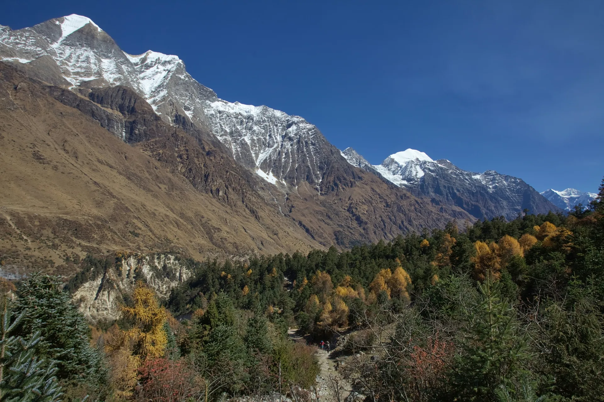
The 14-day Manaslu Circuit Trek circles Mount Manaslu, the world's eighth-highest mountain, taking you from deep river gorges and forested hillsides into a remote Himalayan valley shaped by Tibetan Buddhist culture. Following the Budhi Gandaki River, the trail passes traditional Gurung villages, stone houses, monasteries and mani walls before reaching the high mountain settlements and crossing Larkya La Pass (5,106 m) into the Annapurna region. As a restricted-area trek, Manaslu offers a quieter alternative to Nepal's more established trekking routes. The teahouses are generally simpler, the villages retain strong local traditions, and the changing landscape creates a real sense of traveling into the high Himalayas. The challenge is equally important: expect long walking days, cold nights, basic facilities and a demanding high-altitude pass. This 14-day itinerary includes a full acclimatization day at Samagaun, allowing time to rest and adjust to the altitude before continuing toward Larkya La. The trek finishes at Dharapani, followed by road transport back to Kathmandu. It is best suited to fit trekkers with previous hiking experience who are comfortable with sustained climbs, remote mountain conditions and basic teahouse accommodation.
- Kathmandu
- 14 Days
- 5,106 m
- Moderate
- 14
- Hotel, Teahouse, Lodge
- Breakfast, Lunch, Dinner
Highlights
- Cross Larkya La Pass (5,106 m): Views of Himlung Himal, Cheo Himal, Kang Guru and Annapurna II from the top.
- Walk beneath Manaslu: Spend two nights at Samagaun, a high village at the foot of the world's eighth-highest peak.
- Follow the Budhi Gandaki: Trek upstream through dramatic gorges, suspension bridges and forested valleys.
- See Tibetan Buddhist villages: Pass long mani walls, prayer wheels and monasteries around Lho, Sho and Samagaun.
- Hike on your rest day: Take an optional walk to Birendra Lake near Samagaun, or head toward Manaslu Base Camp.
- Stay at Bimthang: Sleep in a wide glacier basin below the pass, with Manaslu and the surrounding peaks all around.
- Quiet trails: A restricted-area route with far fewer trekkers than the main circuits.
- Finish in the Annapurna region: Walk down through rhododendron forest to Dharapani, where the trail joins the classic Annapurna route.
Itinerary
Day 1: Arrive in Kathmandu (1,400 m)
Our representative will meet you at the airport and take you to your hotel. After checking in, you can rest or wander the nearby streets, depending on when you land.
In the evening, you'll meet your guide over a welcome dinner. Your guide will go through the route, the restricted-area permits and what to expect on the pass day. You'll also hand over your passport and photos for the permit paperwork, so keep them handy. If you need last-minute gear, Thamel's trekking shops are close by.
- Hotel
- Welcome dinner
Day 2: Drive from Kathmandu to Machha Khola (870 m)
Today is a long day on the road. You leave Kathmandu and follow the highway west before turning north through Dhading and Arughat, where the road gets steadily narrower and rougher. The last stretch to the trailhead runs along the Budhi Gandaki valley, past terraced fields, waterfalls and small villages.
Machha Khola is a riverside village with a few teahouses and a lively feel at the end of the road. It's a basic place, so settle in, meet your porters and get an early night before the first walking day.
- 8-10 hours
- Teahousee
- Breakfast, Lunch, & Dinner
Day 3: Trek from Machha Khola to Jagat (1,340 m)
The trek begins with a walk upstream along the Budhi Gandaki, crossing suspension bridges and following narrow trails cut into the valley wall. The path rises and falls through bamboo, sal forest and small villages, with a hot spring at Tatopani if you want a quick stop.
Jagat is a stone-paved village on a ridge, and it's where the restricted area officially begins. Your permits are checked here, so your guide handles the paperwork while you rest. It's a good place for a first look at the more traditional villages ahead.
- 6-7 hours
- 22 km
- Teahouse
- Breakfast, Lunch, & Dinner
Day 4: Trek from Jagat to Deng (1,860 m)
The valley narrows today, and the trail feels more remote. You pass through Salleri and Sirdibas, then descend to Philim, a large Gurung village with fields of millet and barley. Beyond Philim, the path enters a steep gorge with the river roaring far below.
The trail crosses a few long suspension bridges and gradually climbs toward Deng. It's a quiet, forested end to the day, and the gorge walls close in around you. Deng is a small settlement with a few lodges, and the night is cool and clear.
- 6-7 hours
- 16 km
- Teahouse
- Breakfast, Lunch, & Dinner
Day 5: Trek from Deng to Namrung (2,630 m)
Today you cross the river several times and climb steadily through forest toward Ghap, where the first mani walls and prayer wheels appear. The culture changes here, and the houses and chortens begin to look distinctly Tibetan. Above Ghap, the trail climbs through thick forest to Namrung.
Namrung is the first big village at the top of the gorge, with views opening out toward the snow peaks. The final stretch is steep, so take your time.
After the September 2026 floods, you cross temporary bridges near Namrung, and your guide checks conditions before each crossing.
- 6-7 hours
- 15 km
- Teahouse
- Breakfast, Lunch, & Dinner
Day 6: Trek from Namrung to Samagaun (3,530 m)
This is the day the landscape opens up. From Namrung, the trail climbs through the villages of Lihi and Sho, with mani walls, prayer flags and the first big views of Manaslu. You continue to Lho, a large village with a monastery and some of the best mountain views of the trek.
The last stretch leads through Shyala to Samagaun, a wide, stony village with a large monastery and Manaslu right above it. You'll sleep above 3,500 m tonight, so walk slowly and drink plenty of water. Tomorrow's rest day is well earned.
- 6-7 hours
- 14 km
- Teahouse
- Breakfast, Lunch, & Dinner
Day 7: Rest Day at Samagaun (3,530 m); Optional Hike Toward Manaslu Base Camp or Birendra Lake
Today you stay in Samagaun and let your body adjust to the altitude. Sleep in, visit the monastery, wander through the village and enjoy the view of Manaslu, which is hard to stop looking at.
If you feel good, your guide may suggest a hike. Birendra Lake is the shorter option, a glacial lake close to the village with a quiet shoreline and glacier views. The hike toward Manaslu Base Camp is longer and higher, a steady climb that gives you a feel for the altitude ahead. Neither is required, and resting is a perfectly good choice.
- Teahouse
- Breakfast, Lunch, & Dinner
Day 8: Trek from Samagaun to Samdo (3,875 m)
A shorter day takes you higher into the valley. The trail leaves Samagaun and follows the river upstream across open yak pastures, passing stone herders' huts and mani walls. Mountains close in on all sides, and the air is thin and dry.
Samdo is a village close to the Tibetan border, with stone houses and sweeping views. Spend the afternoon resting, taking short walks and drinking water. The cold arrives quickly once the sun drops.
- 3-4 hours
- 8 Km
- Teahouse
- Breakfast, Lunch, & Dinner
Day 9: Trek from Samdo to Dharamsala (Larkya Phedi, about 4,460 m)
Today is a short climb with a big altitude gain. The trail crosses the river, then climbs steadily across rocky slopes and moraine toward Larkya Phedi, also called Dharamsala. The valley feels barren here, with glaciers and peaks around you.
Dharamsala is a basic stone lodge at the foot of the pass, and conditions are simple and often crowded. Eat early, drink hot fluids, check your gear and go to bed. You'll be up in the middle of the night.
- 4-5 hours
- 8 Km
- Lodge
- Breakfast, Lunch, & Dinner
Day 10: Cross Larkya La Pass (5,106 m) and Trek to Bimthang (3,720 m)
Your day starts in the dark, around 3 or 4 AM, with headtorches bobbing along the moraine. The climb to the pass follows a rocky, icy trail across several false summits, and it's slow, cold and long. Your guide sets the pace and decides whether conditions allow the crossing.
At Larkya La, prayer flags crack in the wind, and a huge panorama opens in front of you: Himlung Himal, Cheo Himal, Kang Guru and Annapurna II. After the photos, the long descent begins. It drops steeply over loose moraine and scree and runs for hours, before the valley opens into Bimthang, a wide grassy basin below
- 9-10 hours
- 17 km
- Teahouse
- Breakfast, Lunch, & Dinner
Day 11: Trek from Bimthang to Gho (2515 m)
After yesterday, today feels like a gift. The trail drops through meadows, then enters a rhododendron and pine forest, passing Karche on the way. The air thickens with every step, and the colors change as you lose height.
Gho is a small, quiet village on the hillside, much greener than the high valleys behind you. It's a gentle place to spend a night, and a hot meal here tastes especially good.
- 5-6 hours
- 12 km
- Teahouse
- Breakfast, Lunch, & Dinner
Day 12: Trek from Gho to Dharapani (1,860 m)
The final walking day follows the river down through forest and terraced farmland, passing Tilije and Thonje. You'll notice warmer air, apple orchards and bigger villages as you drop into the Marsyangdi valley.
Dharapani is where the Manaslu Circuit meets the Annapurna Circuit trail. Your Annapurna permit is checked here, and you'll see trekkers coming from the other direction. Celebrate with your guide and porters tonight, because the hardest part is behind you.
- 4-5 hours
- 11 km
- Teahouse
- Breakfast, Lunch, & Dinner
Day 13: Drive from Dharapani to Kathmandu (1,400 m)
After breakfast, a vehicle takes you from Dharapani through Besisahar and back along the highway to Kathmandu. It's a long drive, but the scenery runs from mountains to forest to rice terraces, and it's a good time to share photos and stories.
You'll arrive in the evening and can enjoy a hot shower and a proper dinner in Thamel.
- 8-10 hours
- Hotel
- Breakfast, Lunch
Day 14: Departure from Kathmandu
After breakfast, our representative takes you to the airport for your flight. Let us know your flight time in advance and we'll plan the transfer around it. You leave with sore legs, a full camera roll and a story about Larkya La.
- Breakfast

Included
- Airport pick-up and drop-off by private vehicle
- Hotel stays in Kathmandu (2 nights) with breakfast, twin sharing
- Teahouse and lodge accommodation during the trek (11 nights), twin sharing
- Breakfast, lunch and dinner during the trekking days
- Welcome dinner on Day 1
- Private jeep for road transfers: Kathmandu to Machha Khola and Dharapani to Kathmandu
- Government-licensed, English-speaking trekking guide, with their food, lodging, salary and insurance
- Porter service (one porter for every two trekkers)
- Manaslu Restricted Area Permit (RAP)
- Manaslu Conservation Area Permit (MCAP)
- Annapurna Conservation Area Permit (ACAP)
- Chumnubri Rural Municipality entry fee
- First-aid kit and oximeter carried by the guide
- All government taxes and service charges
Excluded
- International flights to and from Kathmandu
- Nepal entry visa
- Travel insurance with high-altitude trekking and helicopter evacuation cover
- Lunch and dinner in Kathmandu
- Personal trekking gear (can be rented or bought in Kathmandu)
- Bottled water, soft drinks, alcohol and snacks on the trail
- Hot showers, Wi-Fi and device charging at teahouses
- Optional activities not listed as included
- Extra costs from delays, landslides, floods, route closures, itinerary changes or leaving the trek early
- Tips for your guide and porter
Good to know
Manaslu Circuit Trek Map and Route (Machha Khola to Dharapani)
The Manaslu Circuit is a loop around Manaslu, and this itinerary runs it counterclockwise. You follow the Budhi Gandaki River upstream from Machha Khola to the high villages at Samagaun and Samdo, cross Larkya La, and descend to Dharapani in the Marsyangdi valley. Going this way means a steady climb to the pass, which helps your body adjust.
The two long drives, from Kathmandu to Machha Khola and from Dharapani back to Kathmandu, bookend the trek, and everything between is on foot. On the map below, the solid line shows the trekking route and the dashed line shows the road transfers.
Manaslu Circuit Trek Elevation Profile and Daily Sleeping Altitude
The table below combines the 14-day itinerary with daily walking or travel times and overnight sleeping altitudes. It follows the route from Kathmandu to Machha Khola, through the villages of the Budhi Gandaki valley to Samagaun and Samdo, then crosses Larkya La Pass before descending to Bimthang and Dharapani.
Larkya La Pass at 5,106 m is the highest point of the trek, crossed on Day 10. Dharamsala (Larkya Phedi), at approximately 4,460 m, is the highest overnight stop on this itinerary.
14-Day Route and Daily Sleeping Altitude
Day | Route / Daily Plan | Walking / Travel Time | Sleeping Altitude |
1 | Arrive in Kathmandu | Airport transfer | 1,400 m |
2 | Kathmandu → Machha Khola | 8–10 hrs drive | 870 m |
3 | Machha Khola → Jagat | 6–7 hrs walk | 1,340 m |
4 | Jagat → Deng | 6–7 hrs walk | 1,860 m |
5 | Deng → Namrung | 6–7 hrs walk | 2,630 m |
6 | Namrung → Samagaun | 6–7 hrs walk | 3,530 m |
7 | Rest day at Samagaun (optional hike) | Rest or 2–8 hrs hike | 3,530 m |
8 | Samagaun → Samdo | 3–4 hrs walk | 3,875 m |
9 | Samdo → Dharamsala (Larkya Phedi) | 4–5 hrs walk | 4,460 m |
10 | Dharamsala → Larkya La → Bimthang | 9–10 hrs walk | 3,720 m |
11 | Bimthang → Gho | 5–6 hrs walk | 2,515 m |
12 | Gho → Dharapani | 4–5 hrs walk | 1,860 m |
13 | Dharapani → Kathmandu | 8–10 hrs drive | 1,400 m |
14 | Departure from Kathmandu | Airport transfer | — |
Birendra Lake vs Manaslu Base Camp: Which Rest-Day Hike Should You Choose?
Both hikes are optional and take place on Day 7 at Samagaun. Here is how they compare:
Birendra Lake | Toward Manaslu Base Camp | |
Round-trip time | About 2-3 hours | About 6-8 hours |
Effort | Shorter and easier | Longer and higher, with a steady climb |
Best for | Most trekkers who feel well | Strong, well-acclimatized trekkers |
Included in the price | Yes, as an optional hike | Yes, as an optional hike |
Your guide recommends one, or neither, on the morning, based on how you feel and the weather. Resting is a perfectly good choice, especially with Larkya La two days away.
Is 14 Days Enough for the Manaslu Circuit Trek?
Yes, for a standard circuit. Fourteen days gives you ten days on the trail, a full rest day at Samagaun and a driving day at each end. It does not leave much spare time, so weather, bridge repairs or a slow day can eat into the margin.
If you want extra buffer for the pass, an additional acclimatization night or the Tsum Valley, a longer plan is the better choice. Ask us about a custom itinerary.
Manaslu Circuit Trek Cost
The 14-day Manaslu Circuit Trek starts at US$1,050 per person for groups of six or more. The restricted-area permits, guide, porter and jeep costs are shared, so larger groups pay less each. The route, permits and lodges stay the same for everyone, and the package covers all the permits, so there are no separate fees to pay on arrival.
Price by Group Size
Group Size | Price per Person |
1 person | US$1,400 |
2-5 people | US$1,200 |
6+ people | US$1,050 |
We can set up private departures on dates that suit you. Contact us with your preferred dates and group size for availability, or if you want upgrades such as a better hotel in Kathmandu.
Extra Costs on the Manaslu Circuit Trek (Showers, Wi-Fi, Tips)
These are small costs paid in cash along the way. Figures are typical and rise with altitude, and there are no ATMs on the trail.
Item | Typical Cost |
Hot shower | US$3-5 |
Device charging or Wi-Fi | US$1-4 per use |
Bottled or boiled water | US$1-3 per litre |
Snacks and drinks | US$5-10 per day |
Tip for guide | US$10-15 per day, per group |
Tip for porter | US$6-10 per day |
Plan on roughly US$ 200-300 for the whole trek, depending on how often you treat yourself.
How Difficult Is the 14-Day Manaslu Circuit Trek?
The trek is challenging. The days are long, with five to ten hours of walking, and the trail climbs steadily for over a week at increasing altitude. Facilities are basic, the nights are cold, and there is no easy exit once you're in the high valley.
Three days matter most:
Day 6 climbs about 900 m to Samagaun, where you sleep above 3,500 m.
Day 9 gains height again at Dharamsala.
Day 10 is the hardest, starting in the dark, crossing a 5,106 m pass and descending for hours.
You don't need climbing skills, but you do need good fitness, a positive attitude and the ability to keep going when you're tired. Previous trekking experience at altitude helps. See the training plan below.
Acclimatization on the Manaslu Circuit Trek
Two days on this itinerary gain more than the usual advice of adding no more than about 300 to 500 m of sleeping altitude per night above 3,000 m:
Day 6: Namrung (2,630 m) to Samagaun (3,530 m), a gain of about 900 m.
Day 9: Samdo (3,875 m) to Dharamsala (about 4,460 m), a gain of about 585 m.
The plan balances this with a full rest day at Samagaun, a short Day 8 (about 345 m of gain) and a rest-day hike you can use to climb high and sleep low. Our guides keep the pace slow and check oxygen levels and symptoms each morning and evening. If you want a gentler profile, ask us about adding a night on the way up.
Best Time for the Manaslu Circuit Trek
The main trekking seasons are autumn and spring. Conditions vary with snow, rainfall and the year's weather, so no month guarantees an open Larkya La.
Autumn (October to November)
Autumn is the best season, with clear skies, stable weather and the best mountain views. October is the busiest month, but the Manaslu trail is still much quieter than the Annapurna Circuit. Nights get very cold in November.
Spring (March to May)
Spring brings warmer days and rhododendron forests in bloom on the lower trail. Snow can remain on the pass in March and early April, and clouds build in the afternoon, so mornings are best for the crossing.
Winter (December to February)
Winter is very cold, and heavy snow often closes Larkya La. Many lodges in the high villages close for the season. We don't recommend trekking Manaslu in winter.
Monsoon and Early September (June to September)
Heavy rain brings leeches, landslides, slippery trails and the risk of flash floods, as the September 2026 flood near Namrung showed. Views are poor, and some lodges close. If you're traveling in monsoon, ask us about alternatives.
Autumn and spring are generally the most practical choices. Your final decision should account for your dates, tolerance for cold, expected crowds and the latest trail and weather reports.
Manaslu Circuit Trek Permits and Documents
Manaslu is a restricted area, so you need several permits, and everything goes through a registered trekking agency. We arrange them all for you.
Permit | Status | Fee |
Manaslu Restricted Area Permit (RAP) | Required | Seasonal: US$100 for the first 7 days plus US$15 per extra day (September to November), or US$75 plus US$10 per day (December to August) |
Manaslu Conservation Area Permit (MCAP) | Required | NPR 3,000 for foreign nationals |
Annapurna Conservation Area Permit (ACAP) | Required | NPR 3,000 for foreign nationals, because the trail ends at Dharapani |
Chumnubri Rural Municipality fee | Required | Around NPR 1,000 |
Licensed guide | Required | Included on every departure |
Nepal Visa
A tourist visa costs US$30 for 15 days, US$50 for 30 days, and US$125 for 90 days. A 15-day visa covers this 14-day trip with very little margin, so if weather or trail repairs could delay you, the 30-day visa is safer. You can get it on arrival at the airport or pre-apply online. Check eligibility and current fees with the Department of Immigration.
Documents to Carry
Passport valid for at least six months beyond your trip. We need the original for the restricted-area permit
Several passport-size photos
Printed copy of your travel insurance policy
Emergency contact details for Trip Highland and your own family
Paper and digital copies of every document, kept apart from the originals
Travel Insurance and Emergency Evacuation
Travel insurance is not included, and you should buy it before you fly. Your policy must cover trekking up to at least 5,500 m, emergency medical treatment and helicopter evacuation. Check the policy wording for altitude limits, because some standard policies stop at 3,000 m or 4,000 m.
The area is remote and evacuation takes time, so helicopter cover is essential on this route. Your guide carries a first-aid kit and an oximeter and checks symptoms every day. If anyone needs evacuation or urgent medical care, your guide contacts our office and you contact your insurer's emergency line. Keep a printed copy of your policy number and the insurer's 24-hour number with you.
Accommodation During the Manaslu Circuit Trek
Along the trail, you stay in simple teahouses run by local families. Rooms usually have twin beds, foam mattresses and blankets, bathrooms are shared, and the walls are thin. Lower down, villages like Jagat, Deng and Philim are more comfortable. Higher up, around Samagaun and Samdo, the lodges are smaller and colder.
Dharamsala at Larkya Phedi is the most basic stop of all. It's a stone lodge with shared rooms, no heating and limited food. Hot showers, Wi-Fi and device charging cost extra, and in high villages, power is limited to solar. In Kathmandu, you stay in a hotel with breakfast.
Food on the Manaslu Circuit Trek
Menus are broad in the lower villages and shorter at altitude, since everything is carried in by porters and mules. Expect dal bhat, noodles, fried rice, soups, momos, eggs, porridge and Tibetan bread. At higher stops, look for local potatoes, barley and buckwheat dishes. Dal bhat is the best fuel, and you can usually get seconds.
Tell your guide about any dietary needs on day one so they can pass them on to each lodge. Lunch and dinner in Kathmandu are not included.
Altitude Sickness on the Manaslu Circuit Trek
Altitude sickness can affect anyone, however fit or experienced. On this trek you sleep above 3,500 m for five nights, reach about 4,460 m at Dharamsala and cross a pass at 5,106 m. This is a serious altitude trek, and the area is remote, so evacuation takes time.
Three stretches deserve care. On Day 6 you climb about 900 m to Samagaun, which is why the rest day on Day 7 matters. On Day 9 you sleep about 585 m higher than the night before. On Day 10 the pass crossing is long and cold, and it can be affected by weather.
Early Signs of Altitude Sickness (AMS)
Early symptoms of acute mountain sickness (AMS) include headache, nausea, dizziness, tiredness, loss of appetite and poor sleep. Tell your guide at the first hint. Do not keep climbing with symptoms. Mild AMS usually settles with rest and a night at the same altitude. Never go on toward the pass just to complete the itinerary.
Serious Altitude Sickness: When to Descend
Confusion, difficulty walking straight, extreme drowsiness, breathlessness at rest or a persistent cough can indicate a serious emergency, such as swelling of the brain (HACE) or lungs (HAPE). Descend immediately, day or night, and seek medical help. Descent is the only reliable treatment.
Rules to Follow Above 3,000 m
Walk slowly, even when you feel strong
Don't climb higher if you have symptoms
Drink 3 to 4 litres of water daily
Skip alcohol and cigarettes
Take the rest day seriously, and tell your guide how you really feel, every day
Diamox is a prescription medicine some trekkers use to help acclimatize, but it doesn't replace going slowly, so talk to your doctor before you travel. Your guide carries a pulse oximeter, which is useful but can't rule out altitude sickness on its own.
Manaslu Circuit Trek Packing List
Pack for warm, humid valleys, freezing high villages and a snowy pass. Layers matter more than any single item. Your porter carries the duffel (limit 15 kg), and you carry a daypack with the essentials.
Clothing
Moisture-wicking base layers and thermal layers
Warm fleece or insulating mid-layer
Heavy down jacket for Samdo, Dharamsala and the pass
Windproof and waterproof jacket and trousers
Trekking trousers and quick-dry shirts
Warm hat, sun hat, liner gloves and insulated gloves
Footwear and Equipment
Broken-in waterproof trekking boots
Camp shoes or sandals
Trekking poles
Microspikes or light crampons for the pass
Gaiters for snow
Headtorch with spare batteries (essential for Day 10)
Sunglasses with strong UV protection, ideally glacier-rated
Health and Personal Items
Personal medication and a small first-aid kit
Blister plasters
Water purification tablets or a filter
High-SPF sunscreen and lip balm
Toiletries and hand sanitizer
Power bank and charging cable
Luggage, Sleeping Bag and Cash
Pack your main gear in a waterproof duffel. A sleeping bag rated to about -15°C or lower is recommended for Samdo and Dharamsala. Bring Nepali rupees in cash for the whole trek, since there are no ATMs on the trail.
Manaslu Circuit Trek Training Plan (8-10 Weeks)
Start about eight to ten weeks before you travel. This trek asks for stamina on several long days in a row, then a very long pass day.
Weeks | Focus | What to do |
1-3 | Build a base | Brisk walks or runs 3 to 4 times a week for 45 to 60 minutes, plus strength sessions with squats and lunges |
4-6 | Add climbing | Weekend hikes of 4 to 6 hours with a loaded pack, and regular stair climbing |
7-10 | Rehearse | Long hilly hikes on back-to-back days, wearing your boots, plus practice for the cold and early starts |
Practise downhill walking too, since the descent from Larkya La is long and steep. If you have health concerns, talk to your doctor before you travel, and don't rely on fitness alone to prevent altitude sickness.
Extend Your Manaslu Circuit Trek
Extension | Extra Time | Highlights |
Tsum Valley | 7-10 extra days | A remote Buddhist valley with ancient monasteries. Needs a separate restricted-area permit |
Extra rest day at Samagaun | 1 day | More time to acclimatize and attempt both hikes |
Continue into the Annapurna region | 7-12 days | Join the Annapurna Circuit trail from Dharapani toward Manang |
Kathmandu sightseeing | 1 day | Pashupatinath, Boudhanath and Swayambhunath |
Pokhara | 2-3 days | Lakeside relaxation, paragliding and local sightseeing |
Tell Trip Highland how many extra days you have and what you want to experience, and we'll adjust the itinerary.
Why Trek With Trip Highland?
For more than 16 years, Trip Highland has been guiding trekkers through Nepal's mountains. A restricted-area trek like Manaslu needs careful planning, and our team handles the permits, the paperwork and the daily decisions on the trail.
16+ years of experience: Knowledge of Nepal's trekking routes, mountain conditions and local communities
Restricted-area know-how: We arrange all the permits and keep up with trail and bridge conditions, including after the 2026 floods
Safety-conscious planning: A paced itinerary with a rest day at Samagaun, and daily altitude checks
Personalized plans: We adjust dates, pace and extras to suit you
Authentic local culture: Family-run lodges and monasteries, with guides who know the history
Responsible travel: Respect for local customs and the Manaslu Conservation Area
Frequently Asked Questions
How long is the Manaslu Circuit Trek?
This itinerary takes 14 days from Kathmandu back to Kathmandu, with 10 days on the trail (Days 3 to 12), including a rest day at Samagaun. The walking runs from Machha Khola to Dharapani.
How much does the 14-day Manaslu Circuit Trek cost?
The package starts at US$1,050 per person for groups of six or more.A solo traveler pays US$1,400, and groups of 2 to 5 pay US$1,200 per person. The price covers the services listed under "What's Included," including all permits.
What is the highest point of the Manaslu Circuit Trek?
The highest point is Larkya La Pass at 5,106 m, crossed on Day 10. The highest place you sleep is Dharamsala at about 4,460 m.
Is the Manaslu Circuit Trek difficult?
It's challenging. The days are long, the altitude is high, and the facilities are basic. Good fitness, a slow pace and suitable equipment are important, and the pass day is the hardest.
What is the best time for the Manaslu Circuit Trek?
Autumn (October to November) and spring (March to May) are generally the best seasons. Weather and pass conditions vary, so check the latest forecast and trail reports before departure.
Is the Manaslu Circuit open after the September 2026 floods?
A flash flood on September 6, 2026 washed away bridges near Namrung, and trekking on the circuit was suspended for a few days. The Gorkha District Administration Office announced on September 9 that trekking could resume using temporary crossings. Conditions can change, so we check the latest notices before every departure.
Which permits are required for the Manaslu Circuit Trek?
You need a Manaslu Restricted Area Permit, a Manaslu Conservation Area Permit, an Annapurna Conservation Area Permit and a local municipality fee. We arrange all of them.
Can I trek the Manaslu Circuit solo?
Independent trekking isn't allowed in restricted areas, and you need a licensed guide arranged through a registered agency. Whether a minimum of two trekkers is still required has been reported differently, so contact us to confirm the current rule and the solo rate.
What happens if Larkya La is closed or unsafe?
Snow, wind or poor conditions can make the pass unsafe. Your guide will assess conditions and discuss the options, which may include waiting at Dharamsala or Samdo, or turning back. Delays or route changes may result in extra costs, depending on the circumstances and your booking terms.
Do I need travel insurance?
Yes. Your policy should cover trekking up to at least 5,500 m, emergency treatment and helicopter evacuation. It is not included in the package, so buy it before you travel and carry a printed copy.
Are there ATMs or mobile network on the trail?
No ATMs, so bring enough Nepali rupees in cash for the whole trek. Mobile signal is patchy and often disappears in the high villages. Some lodges offer Wi-Fi for a fee, but don't count on it.
How does the Manaslu Circuit compare with the Annapurna Circuit?
Manaslu is quieter, more remote and more basic, with a stronger Tibetan influence in the high villages. The Annapurna Circuit has more teahouses and easier logistics. Ask us if you're unsure which suits you.
Which rest-day hike should I choose at Samagaun?
Birendra Lake is shorter and easier, and it's the better choice for most trekkers. The hike toward Manaslu Base Camp is longer and higher, and best for strong, well-acclimatized trekkers. Your guide will recommend one based on how you feel.
Is vegetarian or vegan food easy to find?
Vegetarian is easy, since dal bhat, vegetable soups, fried rice and momos are on most menus. Vegan takes a little planning: ask for dishes without butter, ghee, cheese or egg, and tell your guide on day one. Menus get shorter at altitude.
How cold does it get at Samdo and Dharamsala?
Very cold. Nights are often well below freezing, and the rooms aren't heated, so you'll want your down jacket by late afternoon, plus a warm sleeping bag and a hat for sleeping.